
Appearance
CP Overview
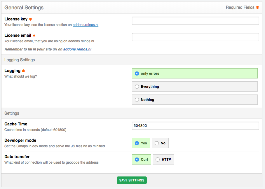
On the CP page you can modify a couple of things.
Settings
- Data transfer: how to get the data from the geocoder, via
HTTPorcURL - What to log: only errors, everything (errors and notices) or nothing
- Cache: enable the file cache for the Maps (by default the results are cached in the database)
- Cache time: how long (in seconds) a result stays in the file cache (default
604800, one week) - Geocode cache time: how long (in seconds) a geocoding result stays in the database cache before it is geocoded again (default
604800, one week) - Cache location: the absolute path to the cache folder. When empty, the
_cachefolder inside the add-on is used - Weather API
- Javascript API geocoding: geocode via
REINOS_MAPS.api('geocode')with the geocoding providers (On, default), only answer with results that are already in the cache (Cache only) or not at all (Off) (from v5.0.0) - Rate limit: the max number of geocoding requests per IP address per minute via the Javascript API (default
30,0is no limit) (from v5.0.0) - Route planner: plan the routes of the route planner with the route providers (
On, default), only answer with routes that are already in the cache (Cache only) or not at all (Off) (from v5.0.0) - Consent: the default of the consent param of the map tag: load the maps directly (
No, default), after a click on a button that is remembered in the browser (Button), or directly for visitors who granted the ExpressionEngine consent request "Maps" (reinos_maps:maps) and with the button for the others (ExpressionEngine consent) (from v5.0.0) - Tile proxy: load the tiles via your own server, see Tile proxy (default
No). With the Tile cache time (days, default30), the Tiles folder and the Tiles URL (empty forimages/reinos_maps_tiles/) (from v5.0.0) - Route planner rate limit: the max number of routes per IP address per minute via the route planner (default
10,0is no limit) (from v5.0.0)
Geocoding providers
Here you can select what Geocoding service you want to use. By default openstreetmap. See Providers and Tiles for the available providers.
The page lists all providers with their status and whether an API key is set. Filter the list on status (enabled or disabled) and a keyword, and click a provider to edit it: enable it and set the API key and extra settings. When more than one provider is enabled, they are tried in the order of the list (OpenStreetMap, Google Maps, Bing Maps). (from v5.0.0)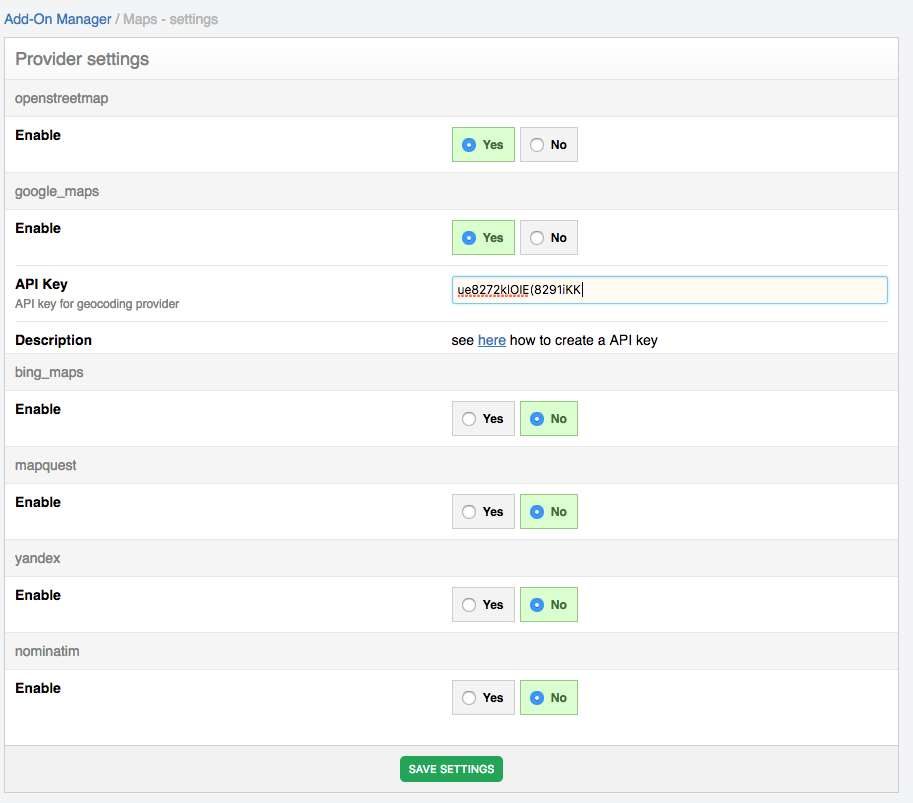
Route providers
Here you can enter the API key for the service that calculates the routes for the route tags. The available route providers are google_maps, openrouteservice, osrm (from v5.0.0, the URL of your OSRM server instead of an API key) and bing_maps.
The page lists the route providers with their status. Filter the list on status (enabled or disabled) and a keyword, and click a provider to edit it: enable it and set the API key (an enabled route provider needs an API key). When more than one is enabled, the first one in the list is used. (from v5.0.0)
Tile Providers
Here you can select the Tile to use as overlay what result in a viewable map. By default openstreetmap. See Providers and Tiles for the available tiles.
The page lists all tiles with their status and whether an API key is set. Filter the list on status (enabled or disabled) and a keyword in the name or label, and click a tile to edit it: enable it, set the label(s) and the API key. When you disable the last tile, openstreetmap is enabled again, so a map always has a tile. (from v5.0.0)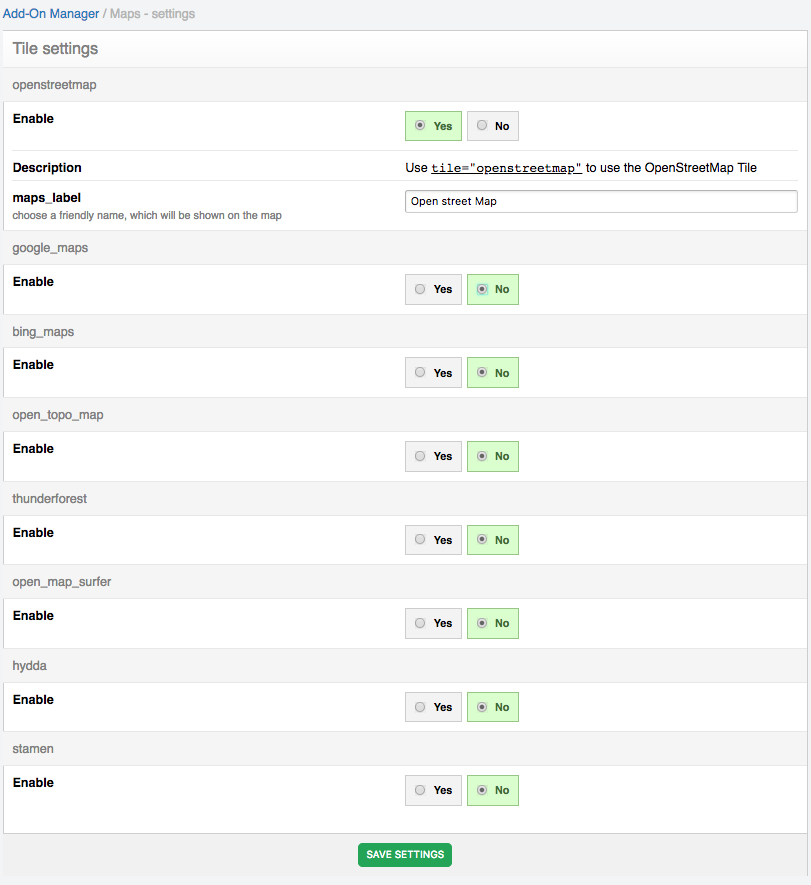
Logs
Maps will log important errors to its own Log overview in the CP (what is logged depends on the "What to log" setting). The overview shows the logs of the current site.
- Filters: filter the logs on severity (error or notice), date (a period or a custom range) and a keyword in the message, and choose how many logs to show per page. The filters stay active when you sort or page through the logs.
- Delete: delete a single log, select logs with the checkboxes and delete them with With selected, or delete all logs of the current site with Delete all logs.
- Export: Export logs downloads the logs as a CSV file (separated by
;), with the active filters applied.
Available from v5.0.0
Diagnostics
Check the setup of Maps on one page (from v5.0.0):
- Environment: the Maps, ExpressionEngine and PHP versions, cURL,
allow_url_fopen(needed for the routes), the data transfer setting, whether the cache folder is writable and, with the tile proxy, whether the tiles folder is writable and how many tiles are cached, and with the vector map whether its file answers range requests and its fonts and icons are there. - Enabled tiles and providers: whether their API key is set, and a Test button per geocoding provider (geocodes "Amsterdam") and route provider (a route from Amsterdam to Utrecht). The test skips the cache, so it shows whether the API key works right now.
- Log: the number of errors in the last 24 hours, with a link to the errors in the log (e.g. a page with a map but without the
html_headerorhtml_footertag).
Cache
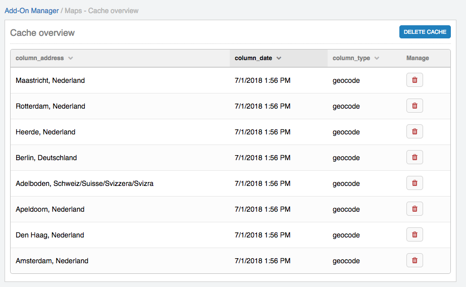
Control all you cached addresses and routes. Be careful with this cached data, delete it only when you have to (due the geocoding limits of Google). The cache is shared by all sites in a multi-site (MSM) install: a geocoded address is the same on every site.
- Filters: filter the cache on type (geocode or route), geocoder, date (a period or a custom range) and a keyword in the address, and choose how many items to show per page. The filters stay active when you sort or page through the cache.
- Delete: delete a single item, select items with the checkboxes and delete them with With selected, or delete all cache at once with Delete Cache (this also deletes the tiles of the tile proxy).
Filters and bulk delete are available from v5.0.0
Weather API
In order to use the Weather API, you need to add a API key from https://openweathermap.org/